




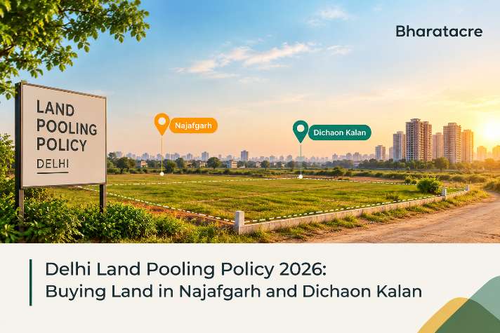
The Delhi land pooling policy lets owners of vacant private land in the city's urban extension villages combine their parcels so a landowner consortium develops 60 percent of the pooled land, with 40 percent going to roads and city services. The Government of India notified the policy on 11 October 2018, and a sector qualifies for development only after pooling 70 percent of its land into one contiguous block. The policy covers about 200 sq km across 105 revenue villages in 6 planning zones, including Zone L, which lists Najafgarh and Dichaon, Kalan.
DDA Land Pooling Rules for Landowners and Consortiums
DDA land pooling uses a single-window process with the authority as facilitator and planner, not developer. The uniform land share replaced an earlier 2-category system that varied returns by holding size, and the policy text, regulations, and village maps are on the official DDA pooling page.
An owner inside a notified village moves through these stages:
Willingness: the owner registers on the online portal, paying an application fee of ₹2,000 per hectare or part for holdings up to 10 hectares.
Verification: the GNCTD Revenue Department checks land details while DDA maps each parcel on a GIS platform.
Consortium: owners in the sector sign a contract, form a consortium and apply with a broad implementation plan.
Licences: a Provisional Development Licence comes first, and the Final Development Licence must follow within 12 months.
Charges: 20 percent of external development charges is paid with the final licence application, and the balance is paid within 90 days or in 8 six-monthly instalments over 48 months.
RERA: every promoter selling units on the consortium's share must register the project under RERA.
Land Pooling Policy Delhi 2026 Status Under MPD-2047
The land pooling policy Delhi 2026 picture changed when the Ministry of Housing and Urban Affairs notified the Master Plan of Delhi 2047, unveiled on 20 August 2026. The new plan replaces the earlier draft DDA MPD-2041, and the Lieutenant Governor cleared it at a DDA meeting on 12 August 2026.
The plan keeps voluntary consortiums, with these changes:
Town Planning Schemes are added as a second model, with a minimum scheme area of 20 hectares.
Inclusive zoning permits a mix of activities on residential plots, linked to the width of the abutting road.
DDA will build every road with a right-of-way of 30 meters or more, within a planned network of over 600 km.
Participation reached more than 7,615 applications and over 7,885 hectares by July 2026, with 16 sectors past the qualifying mark. Sector 8B in Zone P-II, covering Gadi Khasro and Ibrahim Pur villages, became the first sector eligible for development, and owners in 8 more sectors have informed DDA that they are forming consortiums.
L Zone Delhi Villages and Sector Status
L Zone Delhi covers about 21,933 hectares in South West Delhi, with about 11,611 hectares marked urbanisable and about 10,322 hectares under green belt. The zone lies between the Delhi to Rohtak railway line on the north and the NCT boundary on the south and west, with Dwarka on its eastern edge.
Najafgarh is the only census town in Zone L, and its historic core is a Special Area with a separate redevelopment plan. Dichaon Kalan is an urban village of about 1,120 hectares with several unauthorised colonies inside its limits, and both villages appear in the sector plan for land pooling in Najafgarh and the surrounding belt.
Zone L is split into 41 pooling sectors, and DDA's sector-wise status updated to 31 May 2026 shows Sector 3 at 87.48 percent, Sector 13 at 72.15 percent and Sector 40 at 94.70 percent of vacant land pooled. In October 2026, DDA held outreach for Chhawla in Zone L and said it would share the road network plan and parcel details shortly. Buyers comparing Delhi property listings here can match each village to its sector on the published zone maps.
Agricultural Land, Lal Dora and Colony Plots in Dichaon Kalan
Dichaon Kalan land comes in 3 legal forms, each with a different set of rights. GNCTD revenue records record agricultural land by Khasra number, and DDA measures each sector's pooled share against its unbuilt area.
Lal Dora is the old village habitation area marked in red ink on revenue maps, historically without systematic property records. Delhi has begun SVAMITVA smart property cards with a unique Property Identification Number, and surveys are complete, with final cards prepared in 30 of the 48 villages taken up.
A plot in an unauthorised colony is the third category. PM-UDAY recognises ownership in 1,731 listed colonies that existed on 1 June 2014, and the owner receives a Conveyance Deed or Authorisation Slip that must be registered within 3 months of issue. Built-up colony land falls outside the open land DDA counts for pooling, so offers such as the Dichaon Kalan Phase-II plot layout in Najafgarh need to be placed in one of these 3 categories before any payment.
Documents to Check Before Buying Land in Najafgarh
Match the khasra number on the agreement with the current khatauni entry in the seller's name.
Trace the registered chain of sale deeds and confirm mutation in the vendor's favour.
Convert the bigha and biswa figures in the khatauni with an area converter and compare them with the area stated in the sale deed.
Locate the parcel on the Zone L sector map to identify its pooling sector and participation figure.
Ask for the portal application number if the parcel has been offered for pooling, and compare the applicant's name with the owner's.
For a colony plot, confirm the colony is on the notified regularisation list and collect the registered deed or slip.
For a Lal Dora house, ask for the SVAMITVA card or its PID.
For any unit sold by a promoter on pooled land, follow the steps to check RERA and property legal status before booking.
BharatAcre Desk Review of Zone L Pooling Records
We checked DDA's Zone L delineation plan against its latest participation sheet. Our desk found that the plan bases vacant area on 2015 satellite imagery, says this figure does not indicate developable area, and allows boundary changes after ground checks.
The sheet also labels every sector figure as tentative until revenue officials reconcile it, and Zone L shows about 2,065 hectares pooled. A sector number quoted in a sale pitch is a planning reference that can shift, while the revenue entry decides ownership.
Buy the khasra first, then read the sector map. A brochure sector is not a title.
Delhi Land Pooling FAQs
Can small landowners join land pooling in Delhi
You can join with a holding of any size, because the policy allows every owner in a notified village to register willingness. You cannot develop a small parcel alone, though; an individual, developer entity or consortium needs at least 2 hectares to take up development, so small owners usually group with neighbours inside the same sector.
What FAR is allowed under land pooling in Delhi
You get a floor area ratio of 200 for group housing on pooled land under the notified policy. You also receive an extra 15 percent FAR when that added floor area goes to EWS or affordable housing, and tradable FAR lets the developer use the full permitted density inside the consortium's portion of the sector.
When were land pooling villages in Delhi declared urban
You can trace the urban status of these villages to notifications under Section 507 of the DMC Act, 1957, the first issued on 16 May 2017. Separate notifications under Section 12 of the DD Act, 1957 made the same villages DDA development areas, and that development-area status brings them under pooling.
How many homes will land pooling create in Delhi?
Under current DDA estimates, you can expect about 12 lakh new homes from pooled land, compared with the 17 lakh dwelling units announced at the approval stage. That approval also made dual water pipelines mandatory and required at least 10 percent of energy in these sectors to come from solar or other renewable sources.
What is planned along UER-II under land pooling
You will find a High Density Corridor planned along Urban Extension Road II for affordable housing, commercial space, logistics and employment. DDA described this corridor at its recent village outreach camps, together with an infrastructure-first approach in which arterial roads come before sector-level building across Zone L and the neighbouring pooling zones.
How many Lal Dora properties have been surveyed in Delhi
You can gauge progress from the count: 12,232 Lal Dora properties have been surveyed in Delhi, and 8,423 of them were found dispute-free. Each smart card has a QR code that opens the digital record with a sketch, boundaries, and an occupancy certificate, and our property legal services team can read one with you.
When were the Delhi land pooling regulations notified
You can date the operating rules to 24 October 2018, when DDA published the pooling regulations in Gazette S.O. 5384(E). The online portal for expressions of willingness went live on 5 February 2019, and every application since then has passed through that portal before revenue checks and GIS mapping begin.
Where These Pooling Facts Stand Today
Every policy rule, sector figure and scheme detail in this guide was checked on 21 October 2026. Sector percentages move as DDA reconciles fresh applications, so the Zone L figures reflect the latest sheet published on that date.